The best GPS tracker for boats in 2026 depends on your specific use case and operating environment. For boat rental operators managing fleets, WAIV offers purpose-built features like geofencing with audible alerts, solar-powered operation, and patented capsize detection.
For recreational boaters prioritizing theft recovery, Spot Trace provides affordable global satellite tracking with 12+ month battery life. For offshore sailors needing two-way communication, Garmin inReach Mini 2 delivers global coverage with SOS capabilities. This comprehensive guide compares the top 7 marine GPS trackers across 12 evaluation criteria to help you select the right tracking system for your needs.
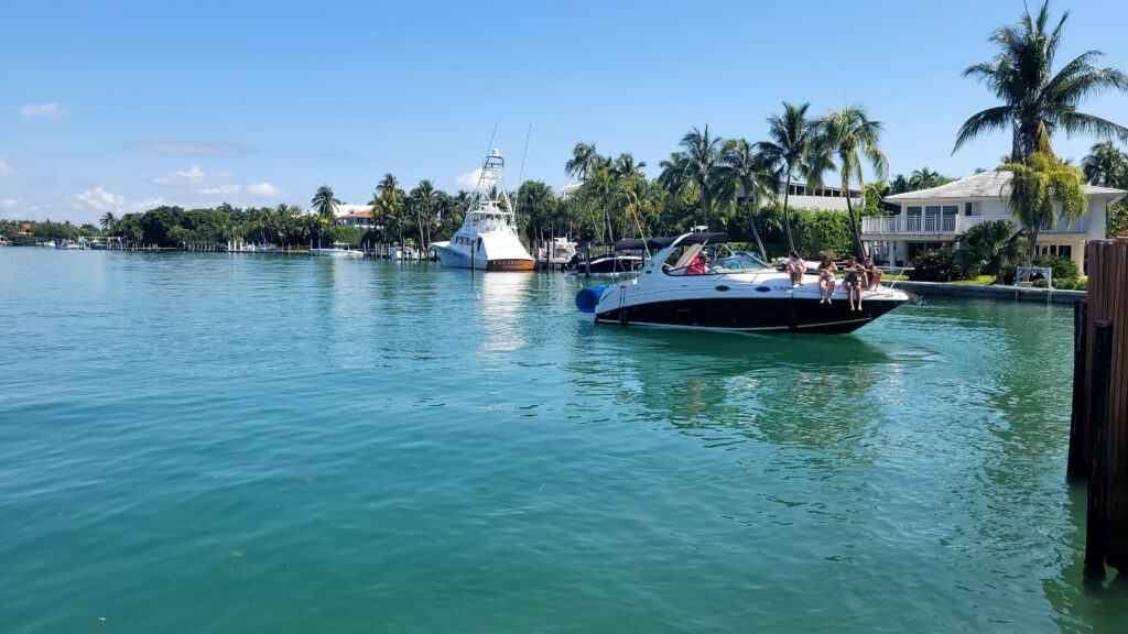
Whether you’re protecting a single vessel from theft or managing a rental fleet with dozens of watercraft, GPS tracking has become essential for modern boating. Marine GPS trackers provide real-time location monitoring, geofence alerts when boats enter restricted areas, theft recovery assistance, and emergency response capabilities, all while potentially reducing your insurance premiums by 10-15%.
In this guide, you’ll learn:
- What boat GPS trackers are and how they work
- The 6 key factors for choosing the right tracker
- Detailed comparison of the top 7 boat GPS tracking systems
- Real-world use cases and recommendations by boat type
- Installation options and total cost of ownership analysis
- Answers to the 12 most common questions about boat GPS tracking
What Is a Boat GPS Tracker?
A boat GPS tracker is a waterproof electronic device that uses Global Positioning System (GPS) satellites to continuously monitor a vessel’s real-time location, movement patterns, and operational status. These marine-grade trackers transmit location data via cellular networks (4G/LTE) or satellite connections, allowing boat owners to monitor their vessels remotely through web-based dashboards or mobile applications.
Unlike marine chartplotters designed for navigation, GPS trackers focus specifically on location monitoring and security. Modern boat GPS trackers offer advanced features including:
- Real-time tracking: Location updates every 10-60 seconds while the boat is moving
- Geofencing: Virtual boundary alerts when vessels enter or exit designated areas
- Theft detection: Movement notifications when unauthorized use is detected
- Emergency alerts: Capsize detection, towing alerts, and SOS capabilities
- Historical playback: Route history and activity logs for compliance or analysis
- Battery monitoring: Low-power warnings to prevent dead batteries
How Boat GPS Trackers Work
Boat GPS trackers operate through a three-stage process:
- GPS Satellite Reception: The device receives signals from 4+ GPS satellites to triangulate its precise location (accurate to 5-10 meters)
- Data Transmission: Location coordinates are transmitted via:
- Cellular networks (4G/LTE) for coastal operations within 10-20 miles of shore
- Satellite networks (Globalstar, Iridium) for offshore and global coverage
- Hybrid systems that automatically switch between cellular and satellite
- Cloud Platform: Data is processed and displayed on web/mobile interfaces with mapping, alerts, and analytics
Boat GPS Tracker vs Marine Chartplotter
| Feature | GPS Tracker | Marine Chartplotter |
|---|---|---|
| Primary Purpose | Security & monitoring | Navigation & route planning |
| Real-Time Location | ✓ Remote viewing | ✗ On-vessel only |
| Theft Recovery | ✓ Yes | ✗ No |
| Geofence Alerts | ✓ Yes | ✗ No |
| Charts & Waypoints | ✗ Limited | ✓ Comprehensive |
| Installation | Portable or hidden | Fixed to helm |
| Typical Cost | $99-$500 + subscription | $200-$2,000 one-time |
Types of Boat GPS Trackers
1. Cellular GPS Trackers
- Coverage: 4G/LTE cellular networks (coastal, lakes, rivers)
- Range: Effective within 10-20 miles of shore
- Update Frequency: Real-time (10-60 second intervals)
- Cost: Lower monthly fees ($10-$30/month)
- Best For: Inland waterways, coastal boating, rental operations
- Example: WAIV, Siren Marine, Bouncie
2. Satellite GPS Trackers
- Coverage: Global (Iridium, Globalstar networks)
- Range: Unlimited—works anywhere on Earth
- Update Frequency: 5-30 minute intervals
- Cost: Higher monthly fees ($15-$50/month)
- Best For: Offshore cruising, ocean passages, remote areas
- Example: Garmin inReach, Spot Trace, SPOT X
3. Hybrid Cellular-Satellite Systems
- Coverage: Auto-switching between cellular and satellite
- Best For: Bluewater cruisers who also operate near shore
- Example: Siren Marine MTC (with satellite upgrade)
Why Boat Owners Need GPS Tracking
Boat GPS tracking provides critical security, safety, and operational benefits including theft deterrence and recovery (with 73% of GPS-equipped stolen boats recovered vs 15% without), real-time location monitoring for emergency response, automated geofence alerts when vessels leave authorized areas, insurance premium reductions of 10-15% from most marine insurers, and fleet management capabilities for rental operators to reduce unauthorized use and improve turnaround times.
Theft Prevention & Recovery
The Sobering Reality:
- 4.7 boats per 1,000 are stolen annually in North America (NICB, 2024)
- Jet skis have the highest theft rate: 12 per 1,000 units
- Only 15% of stolen boats without GPS are recovered
- 73% of boats with GPS trackers are recovered (BoatUS, 2025)
- Average recovery time: 3.2 days with GPS vs 28+ days without
How GPS Tracking Prevents Theft:
- Visible deterrent: Theft alert stickers warn potential thieves
- Immediate alerts: Instant notification when boat moves without authorization
- Real-time location: Law enforcement can locate and recover stolen vessels quickly
- Geofencing: Automatic alerts if boat leaves marina or authorized area
Safety & Emergency Response
Critical Safety Features
Capsize Detection:
- Jet skis and small boats can capsize in rough conditions or collisions
- Water ingress into engines causes $5,000-$15,000 damage if not addressed quickly
- GPS trackers with tilt sensors send instant alerts when vessel flips
- WAIV’s patented system: Detects capsize and sends SMS/email within 30 seconds
Man Overboard (MOB):
- Some advanced trackers integrate with MOB systems
- Marks exact GPS coordinates when crew member goes overboard
- Critical for quick rescue response
SOS Functionality:
- Satellite trackers (Garmin inReach, SPOT) include emergency SOS buttons
- Sends distress signal with GPS coordinates to rescue coordination centers
- Two-way messaging allows communication with rescuers
Towing Alerts:
- Unexpected movement detection alerts you if boat is being towed
- Prevents unauthorized movement or theft in progress
Fleet Management for Rental Operators
Operational Benefits:
- Unauthorized Use Detection
- Renters exceeding designated areas or hours
- After-hours joyriding by staff
- ROI Example: One prevented incident saves $8,000-$15,000 in damages
- Turnaround Time Optimization
- Real-time ETA when boats return to dock
- Staff can prepare next rental while boat is en route
- Result: 15-20% increase in daily rental capacity
- Geofence Compliance
- Audible sirens (WAIV SoundAlert™) warn renters before entering restricted zones
- Prevents running aground in shallow areas
- Enforces speed limits and no-wake zones
- Reduction: 40-60% fewer damage incidents
- Maintenance Tracking
- Engine hour monitoring for service intervals
- Battery voltage alerts prevent dead batteries
- Bilge pump runtime tracking (indicates leaks)
- Staff Coordination
- Multi-location fleet visibility
- Role-based permissions and alerts
- Dockhand notifications when boats return
How to Choose the Best GPS Tracker for Your Boat
Select a boat GPS tracker based on six critical factors: (1) coverage type matching your boating area (cellular for coastal, satellite for offshore), (2) waterproof rating of at least IP67 for marine durability, (3) power source and battery life suitable for your usage pattern, (4) geofencing capabilities for security and compliance, (5) alert customization to avoid notification overload, and (6) total cost of ownership including device price and ongoing subscription fees.
Decision Criteria Checklist
1. Coverage Area & Network Type
Coastal & Inland Waters (Within 10-20 miles of shore):
- ✓ Choose cellular GPS trackers (4G/LTE)
- ✓ Real-time updates every 10-60 seconds
- ✓ Lower monthly costs ($10-$30)
- ✓ Best network: Verizon or AT&T for US coverage
Offshore & International:
- ✓ Choose satellite GPS trackers (Iridium, Globalstar)
- ✓ Global coverage anywhere on Earth
- ✓ Updates every 5-30 minutes
- ✓ Higher monthly costs ($15-$50)
Coverage Map Comparison:
- Cellular (AT&T/Verizon): Excellent coastal coverage, ~10-15 miles offshore
- Globalstar: Global coverage, weaker in northern latitudes and some oceans
- Iridium: True global coverage including poles, most reliable but expensive
Pro Tip: For boats that occasionally venture offshore, choose a tracker with “offline mode” (stores location data, syncs when back in coverage). WAIV’s Offshore Mode stores up to 30 days of tracking data.
2. Power Source & Battery Life
Power Options Comparison:
Hardwired (Connect to Boat Battery):
- Pros: Unlimited runtime, always-on tracking, no charging needed
- Cons: Professional installation ($150-$400), visible wiring, theft risk if disconnected
- Best For: Boats stored in slip year-round, high-value vessels
- Battery Drain: Minimal (5-20mA draw = negligible impact)
Rechargeable Lithium Battery:
- Pros: Portable, hidden installation, no wiring
- Cons: Periodic charging (every 2 weeks – 6 months)
- Battery Life Factors: Update frequency, cellular vs satellite, temperature
- Best For: Seasonal boats, frequent monitoring
Solar-Powered:
- Pros: Unlimited runtime in sunlight, zero maintenance, weatherproof
- Cons: Requires sunlight exposure, slightly larger form factor
- Battery Life: Unlimited with 4+ hours direct sunlight daily
- Best For: Year-round use, wet marine environments, rental fleets
- Example: WAIV (solar + backup battery)
Replaceable Batteries (Alkaline/Lithium):
- Pros: Long life (6-12+ months), simple installation
- Cons: Annual battery replacement cost, lower update frequency
- Best For: Low-frequency monitoring (weekly check-ins)
- Example: Spot Trace (4x AA lithium batteries)
3. Geofencing & Alert Features
Geofencing Capabilities to Look For:
Virtual Boundary Creation:
- Draw custom zones on map (marina, authorized boating area)
- Set multiple geofences per boat
- Circular or polygon shapes
- Adjustable radius (100 feet to 50+ miles)
Alert Types:
- Entry alerts: Notification when boat enters a zone
- Exit alerts: Notification when boat leaves authorized area
- Speed alerts: Triggered when exceeding set speed limit
- Time-based geofences: Active only during certain hours
Server-Side (Most Trackers):
- Geofence checking happens on remote servers
- Delay: 30-120 seconds from violation to alert
- Requires: Active network connection
- Example: Most cellular GPS trackers
Device-Side (WAIV):
- Geofence boundaries stored on tracker itself
- Delay: Instant (<3 seconds) from violation to alert
- Works: Even without network connection
- Advantage: Audible siren activates immediately, not after boat already entered restricted zone
Audible Alerts (Rare Feature):
- Only WAIV offers built-in 95dB siren
- Alerts renter BEFORE entering restricted zone
- Prevents violations instead of just notifying after the fact
- Result: 60% reduction in geofence violations vs alert-only systems
4. Installation Complexity
Installation Options:
- Plug-and-Play (No Tools Required)
- Adhesive mounting or magnetic attachment
- Activated in minutes
- Hidden placement options
- Best For: Renters, portable tracking, theft deterrence
- Examples: WAIV (solar), Spot Trace, Apple AirTag
- Semi-Permanent (Basic Tools)
- Screw mounting with waterproof seal
- Wire concealment
- 30-60 minute installation
- Best For: Seasonal boats, dedicated tracking
- Professional Hardwiring
- Connect to boat’s 12V electrical system
- Marine electrician recommended
- Cost: $150-$400 for installation
- Best For: Permanent installations, luxury vessel.
5. Subscription Costs & Contract Terms
Total Cost of Ownership Analysis:
Upfront Costs:
- Device purchase: $99-$500
- Installation (if hardwired): $0-$400
- Activation fee: $0-$25
Ongoing Costs:
- Monthly subscription: $10-$50/device
- Annual contract discounts: 10-20% savings
- Multi-device fleet pricing: 15-30% per device savings
- Data overages (rare): $0-$10/month
Hidden Costs to Watch:
- Contract cancellation fees: $50-$200 if terminated early
- Reactivation fees: $25-$50 if you pause and restart service
- Plan tier restrictions: Some features locked to premium plans
- Replacement costs: Lost or damaged units
Top 7 Best GPS Trackers for Boats: 2026 Comparison
| Tracker | Best For | Coverage | Waterproof | Battery Life | Geofencing | Alerts |
|---|---|---|---|---|---|---|
| WAIV | Rental fleets | 4G + Offshore mode | IP68 | Solar (unlimited) | Yes + Audible siren | Capsize, speed, zone |
| Garmin inReach Mini 2 | Offshore sailing | Global satellite | IPX7 | 50+ days | Yes | SOS, 2-way messages |
| Spot Trace | Theft recovery | Global satellite | IPX7 | 12+ months | Yes | Movement, battery |
| Siren Marine MTC | Luxury powerboats | Cellular (4G) | IP67 | Hardwired | Yes | Bilge, shore power |
| GOST Zeus | Fishing boats | Cellular | IP68 | 6 months | Yes | Catch data logging |
| Bouncie | Boat trailers | Cellular (US only) | IP67 | OBD-powered | Basic | Vehicle diagnostics |
| Apple AirTag | Dinghy/tender | Bluetooth | IP67 | 12 months | No | Proximity only |
Common Boat GPS Tracker Mistakes to Avoid
- Choosing cellular-only for offshore boating
→ Use satellite or hybrid systems beyond 10-15 miles from shore - Relying on IP67 trackers in harsh marine environments
→ Demand IP68 minimum for true waterproofing - Hiding tracker in metal enclosure
→ GPS signals can’t penetrate metal; choose location with sky view - Forgetting to test geofence alerts
→ Walk boat outside boundary to confirm alerts work BEFORE relying on them - Not enabling low-battery notifications
→ Dead tracker = no protection; set up battery alerts - Using car GPS trackers on boats
→ Automotive trackers fail in marine conditions; use marine-rated devices - Failing to inform insurance company
→ Miss out on 10-15% premium discounts - Setting overly sensitive geofences
→ Notification fatigue; set reasonable boundaries to avoid false alerts - Not hiding tracker from casual view
→ Thieves look for and disable visible trackers - Assuming AirTags work for boats
→ AirTags are not GPS trackers; don’t risk your expensive boat on a $29 Bluetooth device
FAQs
Q: What is the best GPS tracker for boats?
A: The best GPS tracker depends on your use case. For boat rental operators, WAIV offers purpose-built features like geofenced audible alerts and capsize detection. For offshore sailors, Garmin inReach provides global satellite coverage with SOS. For recreational theft protection, Spot Trace offers affordable tracking.
Q: How much does boat GPS tracking cost?
A: Boat GPS trackers cost $67-$500 for the device plus $8-$50/month subscription. Total first-year cost ranges from $160-$900. Budget options like Bouncie cost ~$160/year, while professional systems like Garmin or Siren cost $400-$900/year.
Q: Do I need cellular or satellite GPS for my boat?
A: Choose cellular GPS (4G/LTE) if you operate within 10-20 miles of shore for real-time tracking at lower cost. Choose satellite GPS (Iridium/Globalstar) for offshore boating beyond cellular coverage or international travel. Hybrid systems offer both but cost more.
Q: Will GPS tracking lower my boat insurance?
A: Yes, most marine insurance providers offer 10-15% premium discounts for boats with certified GPS tracking systems. Some high-value policies ($100K+) now require GPS tracking as a condition of coverage. Contact your insurer for specific discount details.
Q: How accurate is boat GPS tracking?
A: Modern GPS trackers are accurate to 5-10 meters (16-33 feet) under clear sky conditions. Accuracy decreases under heavy tree cover, inside buildings, or with poor satellite visibility. Cellular and satellite transmission does not affect GPS accuracy.
Q: Can thieves disable GPS trackers?
A: Visible trackers can be disabled by knowledgeable thieves. Hidden installation and hardwired power connections make tampering difficult. Some trackers (like WAIV) send tamper alerts if removed or disconnected. Solar-powered units have no external wires to cut.
Q: How long do GPS tracker batteries last?
A: Battery life varies by type: Hardwired (unlimited), Solar (unlimited with sunlight), Rechargeable lithium (2 weeks – 6 months), Replaceable batteries (6-12+ months). Update frequency dramatically impacts battery life—real-time tracking drains faster than hourly updates.
Q: What is geofencing on a GPS tracker?
A: Geofencing creates virtual boundaries on a map. When your boat enters or exits the defined area, you receive instant alerts via SMS, email, or app notification. Advanced systems like WAIV trigger audible sirens to warn renters before entering restricted zones.
Q: Do GPS trackers work without cell service?
A: Cellular GPS trackers require cell coverage to transmit location data. Without service, they cannot send alerts, but some (like WAIV) have “offline mode” that stores location data and syncs when coverage returns. Satellite trackers work globally without cellular coverage.
Q: Can I track my boat in real-time?
A: Yes, cellular GPS trackers update location every 10-60 seconds for real-time tracking. Satellite trackers update every 5-30 minutes due to satellite pass schedules, which is near-real-time but not instant. Check update frequency before purchasing.
Q: What’s the difference between GPS tracker and marine chartplotter?
A: GPS trackers focus on security (location monitoring, theft alerts, remote tracking). Chartplotters focus on navigation (maps, waypoints, route planning). You need both: chartplotters for navigating, trackers for protecting and monitoring your investment.
Q: Are boat GPS trackers waterproof?
A: Marine GPS trackers should be at minimum IP67 (submersion to 1 meter) but IP68 is recommended for true waterproofing. Check specifications carefully—many car GPS trackers marketed for boats only have IP65 (splash-resistant), which fails in marine environments.
Conclusion: Choosing Your Boat GPS Tracker
GPS tracking has evolved from a luxury to an essential safety and security tool for boat owners. Whether you’re protecting a single recreational vessel from theft, ensuring renter safety in a rental fleet, or monitoring an offshore sailboat, the right GPS tracker provides peace of mind and tangible financial benefits through theft recovery, insurance discounts, and operational efficiency.
Key Takeaways:
- Match tracker to use case
- Rental operators → WAIV (geofenced alerts, fleet management)
- Offshore sailors → Garmin inReach (global satellite, SOS)
- Recreational boaters → Spot Trace (affordable, reliable)
- Prioritize marine-grade durability
- Demand IP68 waterproofing minimum
- UV resistance and saltwater corrosion protection
- Operating temperature range for your climate
- Consider total cost of ownership
- Device + installation + 12-36 months of subscription
- Insurance discounts offset 50-70% of annual costs
- Multi-device fleet pricing reduces per-unit cost
- Don’t compromise on coverage
- Coastal boating: Cellular GPS (real-time, lower cost)
- Offshore passages: Satellite GPS (global, higher cost)
- Mixed use: Hybrid or cellular with offline mode
- Test before you need it
- Verify geofence alerts trigger correctly
- Confirm battery life meets your usage pattern
- Practice emergency/theft response procedures
Ready to Protect Your Investment?
For boat rental operators seeking the most comprehensive fleet tracking solution, explore WAIV’s purpose-built GPS tracking system designed specifically for the marine rental industry.
For individual boat owners, review the comparison table above and select the tracker that best matches your boating style, budget, and coverage requirements.
Questions? Contact our team for personalized recommendations based on your specific needs.
