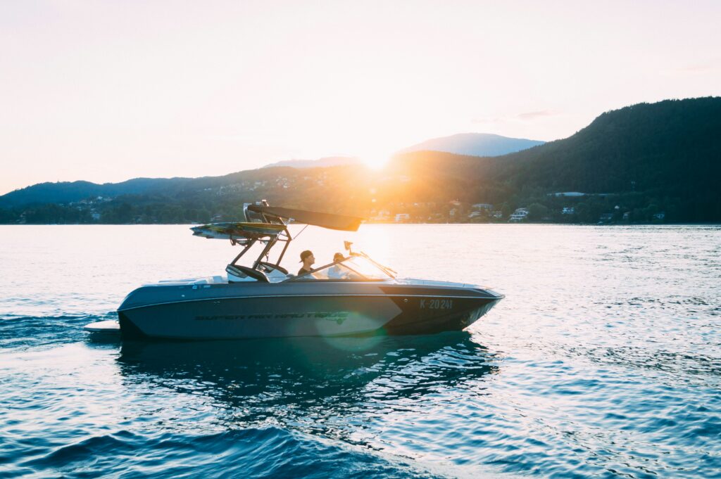
If you’ve ever laid awake at night wondering where your boat is—or worse, woken up to find an empty slip where your vessel should be—you know that sick feeling in your stomach. I’ve talked to hundreds of boat owners over the years, and the story is almost always the same: “I wish I’d installed a tracker before this happened.”
Here’s what most people don’t realize: modern boat tracking devices aren’t just for recovering stolen boats anymore (though they’re excellent at that). They’ve evolved into sophisticated systems that can prevent your jet ski from capsizing unnoticed, alert you when a renter is about to plow into shallow water, and even help you trim 15% off your insurance premiums.
In this guide, I’ll break down everything you actually need to know about boat tracking devices—cutting through the marketing fluff to focus on what matters when you’re choosing one for your situation.
What Are Boat Tracking Devices?
Quick Answer: Boat tracking devices are waterproof electronic units that continuously monitor your vessel’s location using GPS satellites and transmit that data via cellular or satellite networks. Unlike marine chartplotters that help you navigate, tracking devices tell you where your boat IS and alert you when something’s wrong—whether that’s unauthorized movement, a geofence violation, or a capsize event.
Think of it like this: your car’s navigation system helps you get somewhere. But if someone steals your car, that built-in GPS won’t help you find it. That’s the fundamental difference between navigation and tracking.
Why This Matters More Than Ever
Back in 2015, I watched a friend lose his $45,000 center console to thieves who hit three marinas in one night. No GPS tracker. No recovery. Just an insurance battle and a lot of regret.
Fast forward to 2026, and boat theft is up 12% from five years ago (according to the National Insurance Crime Bureau). But here’s the flip side: boats equipped with GPS trackers have a 73% recovery rate. Without one? That drops to about 15%. The math is pretty simple.
The Types of Boat Tracking Devices
Not all tracking devices are created equal. Here’s what’s actually available:
1. Cellular GPS Trackers
These use 4G/LTE cell networks to transmit location data. They’re perfect if you stick to coastal waters, lakes, and rivers—basically anywhere within 10-20 miles of shore where cell service exists.
Pros:
- Real-time updates (every 10-60 seconds)
- Lower monthly costs ($10-$30)
- Better battery life than satellite
- Works great for 95% of recreational boating
Cons:
- Dead zones once you’re offshore
- Useless if cell towers are down
- Coverage gaps in remote areas
Best for: Coastal cruising, lake boating, river navigation, rental fleets
2. Satellite GPS Trackers
These bad boys communicate with satellites orbiting Earth, so they work literally anywhere—mid-ocean, polar regions, wherever.
Pros:
- True global coverage
- Works beyond cell range
- Reliable in emergencies
- No “dead zones”
Cons:
- Higher monthly fees ($15-$50)
- Slower updates (5-30 minute intervals)
- More expensive upfront
- Some networks have gaps (Globalstar struggles in northern latitudes)
Best for: Offshore cruising, ocean passages, commercial fishing, bluewater sailing.
3. Hybrid Systems
The best of both worlds—these automatically switch between cellular (when available) and satellite (when offshore).
Example: Some high-end systems use cellular for real-time tracking near shore, then switch to satellite if you venture beyond coverage. You get fast updates when possible and global reach when needed.
Best for: Boats that do both coastal and offshore trips
How Boat Tracking Devices Actually Work
Let me demystify the technology without getting too nerdy.
Step 1: GPS Positioning
Your tracker has a GPS receiver that listens to signals from multiple satellites orbiting Earth (usually 4-6 satellites at once). By measuring how long each signal takes to arrive, it triangulates your exact position—usually accurate to within 5-10 meters.
Fun fact: GPS works the same everywhere, whether you’re using cellular or satellite for transmission. The GPS accuracy doesn’t change—only how that data gets sent to you changes.
Step 2: Data Transmission
This is where cellular and satellite trackers differ:
Cellular trackers send your location through cell towers (same network as your phone). Fast, cheap, but limited to coverage areas.
Satellite trackers beam data to communication satellites (like Iridium or Globalstar networks) that relay it to ground stations. Slower, more expensive, works everywhere.
Step 3: Cloud Platform
Your tracking data lands in a cloud-based system that processes it and displays it on maps through web dashboards or mobile apps. This is where you actually see where your boat is, set up geofences, and manage alerts.
Key Features That Actually Matter
After evaluating dozens of tracking devices, here are the features that separate the useful from the useless:
1. Waterproof Rating (Non-Negotiable)
Look for IP68 rating minimum. I cannot stress this enough.
I’ve seen boat owners buy automotive GPS trackers with IP67 ratings (splash-resistant) and watch them fail within months in a marine environment. IP67 means submersion to 1 meter for 30 minutes. IP68 means true waterproofing for deeper/longer submersion.
What to check:
- IP68 or marine-grade waterproofing
- UV-resistant housing
- Saltwater corrosion protection
- Operating temperature range (-20°F to 140°F minimum)
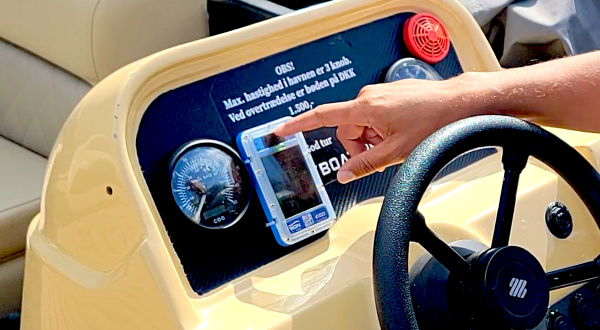
2. Geofencing with Instant Alerts
Geofencing lets you draw virtual boundaries on a map. When your boat crosses that line—boom, you get alerted via SMS, email, or app notification.
But here’s where it gets interesting: some systems (like WAIV) process geofences ON the device itself, triggering alerts in under 3 seconds. Most trackers process geofences on remote servers, which means 30-120 second delays.
Why this matters: If a renter is barreling toward a no-wake zone at 40 mph, you want them warned BEFORE they enter it, not after they’ve already violated the boundary and are halfway to a citation.
Advanced geofencing features to look for:
- Multiple zones per boat
- Time-based geofences (active only during rental hours)
- Speed-based alerts within zones
- Audible on-device alarms (rare but game-changing)
3. Battery Life and Power Options
This is where people make expensive mistakes.
Hardwired trackers connect to your boat’s battery. Unlimited runtime, always-on tracking, but require professional installation ($150-$400) and thieves can potentially cut the power.
Rechargeable battery trackers are portable and hidden easily, but you’re charging them every 2 weeks to 6 months depending on settings. Miss one charging cycle during peak season, and your tracker is useless when you need it most.
Solar-powered trackers (my personal favorite for most use cases) use solar panels to recharge continuously. With just 4-6 hours of sunlight daily, they run indefinitely. No charging, no battery anxiety, no surprises.
Replaceable battery trackers use standard AA or lithium batteries lasting 6-12+ months. Simple but requires annual swaps.
4. Update Frequency
How often do you actually need to know where your boat is?
Real-time tracking (10-60 seconds): Cellular trackers excel here. Perfect for active monitoring of rentals or watching your boat move in real-time.
Interval tracking (5-30 minutes): Common with satellite trackers. Fine for theft recovery or checking on boats periodically.
On-demand “ping”: Some budget trackers only report location when you request it. Terrible for security, fine for occasional check-ins.
My take: For rental operations or high-theft areas, get real-time. For personal boats in secure marinas, interval tracking is usually sufficient.
5. Theft Recovery Features
The whole point of a tracker is getting your boat back if it’s stolen. Here’s what actually helps:
Hidden installation: Discrete mounting locations that aren’t obvious to thieves
Tamper alerts: Notifications if the device is removed or power is cut
Movement detection: Alerts when the boat moves without authorization
Historical playback: See exactly where your boat went after it was taken (helps law enforcement)
Silent mode: Some trackers can operate without any visible indicators so thieves don’t know they’re being tracked
6. Temperature and Environmental Monitoring (Bonus Features)
Higher-end trackers can monitor:
- Battery voltage (avoid dead batteries)
- Bilge pump activity (detect leaks early)
- Engine hours (maintenance scheduling)
- Shore power status
- Cabin temperature
These aren’t essential for everyone, but if you’re managing a fleet or have a high-value vessel, they provide early warning of problems.
Top Boat Tracking Devices Compared
| Tracker | Type | Best For | Waterproof | Battery | Geofencing | Price | Monthly | Rating |
|---|---|---|---|---|---|---|---|---|
| WAIV | Cellular | Rental fleets | IP68 | Solar | ✓ Yes + Audible alerts | Quote | Quote | 4.8 / 5 |
| Garmin inReach Mini 2 | Satellite | Offshore cruising | IPX7 | 50+ days | ✓ Yes | $399 | $15+ | 4.7 / 5 |
| Spot Trace | Satellite | Budget theft recovery | IPX7 | 12+ months | ✓ Yes | $99 | $13 | 4.4 / 5 |
| Siren Marine MTC | Cellular | Luxury powerboats | IP67 | Hardwired | ✓ Yes | $299 | $30 | 4.5 / 5 |
| Bouncie | Cellular | Trailer tracking only | IP67 | OBD-powered | Basic | $67 | $8 | 4.2 / 5 |
The Rental Operator's Choice: WAIV
If you’re running boat or jet ski rentals, WAIV stands apart for one simple reason: it’s the only system actually designed for rental operations from the ground up.
What makes it different:
Geofenced Audible Alerts: A 95dB siren triggers the INSTANT a renter crosses a boundary. Not 60 seconds later after they’re already in trouble—immediately. This prevents violations instead of just reporting them.
I’ve seen this feature personally at a Lake Tahoe rental operation. Before WAIV, they were dealing with 2-3 grounding incidents per week. After installation? Down to maybe one per month. The siren literally trains renters to stay in bounds.
Solar-Powered Operation: No wiring, no battery charging, no maintenance. Just mount it somewhere with sun exposure and forget about it.
Capsize Detection: Jet skis flip. It happens. WAIV’s tilt sensors detect capsizing within 30 seconds and alert you immediately. This prevents $5,000-$15,000 engine damage from water ingress.
Fleet Management Dashboard: Monitor 10 to 500+ vessels from one interface. Multi-location support. Role-based staff permissions. Returning vessel alerts so dock staff can prep the next rental.
The catch: It’s not the cheapest option upfront, and it’s overkill for single recreational boat owners. But for rental operations? The ROI is typically 3-6 months based on damage prevention alone.
The Offshore Sailor's Choice: Garmin inReach Mini 2
For bluewater cruising, Garmin’s inReach Mini 2 is the gold standard.
Key advantages:
- True global coverage via Iridium satellites
- Two-way text messaging (communicate beyond cell range)
- Dedicated SOS button connecting to GEOS rescue coordination
- Weather forecasts and routing
- 50+ day battery life
Real-world example: A couple cruising the Pacific used inReach to request medical evacuation when one of them developed appendicitis 300 miles from land. The SOS button connected them to emergency services, they texted their exact location and symptoms, and a helicopter was dispatched. That device literally saved a life.
The downside: $15-$65/month depending on your plan, and updates come every 10 minutes instead of real-time.
The Budget Option: Spot Trace
If you just want basic theft recovery for a seasonal boat, Spot Trace delivers solid value.
What you get:
- Global satellite coverage via Globalstar
- 12+ month battery life on standard AA lithium batteries
- Movement alerts and tracking
- Basic geofencing
- $99 device + $13/month
What you don’t get:
- Real-time tracking (5-30 minute intervals)
- SOS or two-way messaging
- Advanced features like capsize detection
- Perfect coverage (Globalstar has gaps in some oceans and northern latitudes)
Best use case: Seasonal boats in storage. Set it to motion-detection mode. If someone moves your boat without permission, you get alerted and can see where it’s going.
Installation: What You're Actually Getting Into
Plug-and-Play Installation (15-30 minutes)
Examples: WAIV, Spot Trace, AirTag alternatives
Process:
- Choose mounting location (clear sky view for GPS, protected from direct spray)
- Clean surface with isopropyl alcohol
- Peel adhesive backing and stick it down
- Activate through app/website
- Set up geofences and alerts
Pro tip: Don’t mount trackers in metal enclosures. GPS signals can’t penetrate metal well. Choose fiberglass, plastic, or open locations.
Hardwired Installation (2-4 hours + professional recommended)
Examples: Siren Marine, high-end Garmin systems
Process:
- Disconnect boat battery (safety first)
- Run power wires through existing conduit or drill new routes
- Connect to 12V fused circuit
- Waterproof all connections with marine-grade heat shrink
- Mount device in protected location
- Test before finalizing
Cost: $150-$400 if you hire a marine electrician (recommended unless you’re experienced)
Advantage: Unlimited runtime, always-on tracking, can tap into existing boat systems
Disadvantage: More complex, visible wiring that could alert thieves, power can be cut
Common Mistakes People Make
Let me save you from the errors I see repeatedly:
- Buying automotive trackers for boats
Car GPS trackers might seem cheaper, but they’re not built for marine conditions. Within 6-12 months, saltwater corrosion will kill them. Spend the extra money on a marine-rated device.
- Ignoring the waterproof rating
“Water-resistant” is not the same as “waterproof.” Demand IP68 minimum. I’ve seen too many IP67-rated trackers fail after one season.
- Hiding trackers in metal compartments
GPS signals struggle through metal. If you bury your tracker deep inside a metal anchor locker, don’t be surprised when it can’t get a fix.
- Not testing geofence alerts
Set up your geofences, then actually TEST them. Walk or drive the boat outside the boundary to confirm alerts work. Don’t wait until there’s a real violation to discover your settings are wrong.
- Forgetting to notify insurance
Most marine insurers offer 10-15% discounts for GPS-tracked boats. That’s $150-$300/year in savings on a typical policy. Call your agent and get the discount—it pays for the tracker subscription.
- Setting overly sensitive boundaries
If your geofence triggers every time wind pushes your boat 50 feet at the dock, you’ll get alert fatigue and start ignoring them. Be realistic with your boundaries.
- Using cheap trackers for expensive boats
Don’t protect a $50,000 boat with a $29 bluetooth tracker. Match the security level to the asset value.
FAQs
Q: Will a GPS tracker drain my boat battery?
A: Hardwired trackers draw 5-20 milliamps, which is negligible—about the same as a bilge pump float switch. Solar and battery-powered trackers don’t touch your boat battery at all.
Q: Can thieves disable my tracker?
A: If they know it’s there, yes. That’s why hidden installation matters. Hardwired trackers can have power cut. Battery/solar trackers can be physically removed if discovered. But most boat thieves aren’t sophisticated enough to search for trackers—they hit-and-run quickly.
Q: How accurate is GPS tracking on water?
A: 5-10 meters (16-33 feet) under clear sky conditions. Accuracy decreases under heavy cloud cover or near tall structures, but rarely enough to matter for tracking purposes.
Q: Do I need WiFi on my boat for a tracker to work?
A: No. Cellular trackers use cell networks (like your phone). Satellite trackers use satellite communication. Neither requires WiFi.
Q: What happens if my tracker loses signal?
A: Depends on the system. Basic trackers stop reporting. Better systems (like WAIV’s Offshore Mode) store location data locally and sync when signal returns—so you don’t lose the tracking history.
Q: Can I track multiple boats with one account?
A: Yes, most platforms let you add multiple devices to one account, often with fleet pricing discounts for 3+ units.
Q: Will tracking devices work internationally?
A: Satellite trackers work globally. Cellular trackers depend on roaming agreements—check with your provider before heading to foreign waters.
Q: How long until a GPS tracker pays for itself?
A: Through insurance discounts alone, usually 2-3 years. Factor in preventing even ONE theft or grounding incident, and ROI becomes immediate.
