What Is a GPS Locator for Boats?
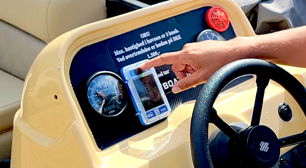
A GPS locator for boats is a device that determines your vessel’s precise position using signals from GPS satellites orbiting Earth, then transmits that location data to you via cellular or satellite networks. It tells you where your boat IS right now (real-time tracking) or where it WAS (historical tracking), allowing remote monitoring from anywhere with internet access.
Think of it as a combination of three technologies working together:
- GPS positioning (figuring out where the device is)
- Data transmission (sending that info to the cloud)
- User interface (showing you the location on a map)
Each piece is equally important. Great GPS with terrible transmission is useless. Perfect transmission of bad GPS data is useless. And both are useless if the interface is confusing.
How GPS Actually Works (The Simple Version)
Let’s start with the GPS part, which is the foundation of everything.
The Satellite Network
Right now, there are 31 active GPS satellites orbiting Earth at about 12,550 miles altitude. They’re spread out so that from any point on Earth, you can “see” at least 4 satellites at once.
Each satellite broadcasts a very precise timestamp—basically saying “I sent this signal at exactly 12:34:56.789 PM.”
Your GPS locator receives these timestamps from multiple satellites simultaneously.
Triangulation (Actually Trilateration)
Here’s where it gets clever:
Satellite A’s signal arrives → Your device calculates: “This signal took 0.067 seconds to reach me, traveling at the speed of light, so Satellite A is 12,427 miles away.”
Satellite B’s signal arrives → “Satellite B is 11,892 miles away.”
Satellite C’s signal arrives → “Satellite C is 13,004 miles away.”
Satellite D’s signal arrives → “Satellite D is 12,156 miles away.”
With four satellites, your GPS locator can pinpoint your EXACT position in three-dimensional space (latitude, longitude, and altitude).
It’s like if four people told you they were each exactly X feet away from you. Draw circles around each person at the right distance, and there’s only ONE spot where all four circles overlap. That’s where you are.
Accuracy: What to Expect
Consumer GPS accuracy: 5-10 meters (16-33 feet) under clear sky conditions
What affects accuracy:
- Number of satellites in view (more = better)
- Satellite geometry (spread out = better than clustered)
- Atmospheric conditions
- Obstructions (buildings, trees, mountains)
- Device quality
Practical implications: GPS is accurate enough to tell you which marina your boat is in, but not which slip. It’ll show you the boat is near a reef, but not exactly how close.
For tracking purposes, 16 feet of accuracy is more than sufficient. You’re not trying to land airplanes—you’re just trying to find your boat.
How Location Data Gets to You
Okay, your GPS locator knows where it is. Now what?
This is where cellular and satellite trackers diverge dramatically.
Cellular GPS Locators
The Network: Your tracker contains a cellular modem (like a phone) that connects to cell towers. It uses 4G/LTE networks to transmit data.
How it works:
- GPS determines location every 10-60 seconds
- Cellular modem sends that data to the cloud via cell network
- Cloud platform processes and displays on your dashboard
- You see real-time movement on a map
Update Frequency: Every 10-60 seconds while moving (real-time)
Coverage Area: Anywhere with cell service—typically 10-20 miles offshore in the US, further in some areas, less in others
Cost: Lower monthly fees ($10-$30) because cellular data is cheap
Pros:
- Fast, real-time tracking
- Lower operating costs
- Better for high-traffic monitoring
Cons:
- Dead zones offshore and in remote areas
- Dependent on cell network reliability
- International coverage varies
Best for: Coastal boating, lakes, rivers, rental operations
Satellite GPS Locators
The Network: Your tracker uses specialized satellite communication networks (Iridium, Globalstar, Inmarsat) completely separate from GPS satellites.
Yes, it’s confusing: GPS satellites tell you WHERE you are. Communication satellites send that data to the cloud. Two different systems working together.
How it works:
- GPS determines location
- Tracker stores location and waits for communication satellite pass
- When satellite is overhead, tracker beams data to it
- Satellite relays to ground station, which sends to cloud
- You see the update (5-30 minute delay typical)
Update Frequency: Every 5-30 minutes depending on plan and satellite passes
Coverage Area: Literally global—works at the North Pole, mid-Pacific, anywhere
Cost: Higher monthly fees ($15-$50) because satellite data is expensive
Pros:
- Works everywhere on Earth
- No coverage gaps
- Reliable in emergencies
Cons:
- Slower updates (not true real-time)
- Higher operating costs
- Potential satellite pass delays
Best for: Offshore cruising, ocean passages, commercial fishing
Geofencing: Virtual Boundaries in Real Water
One of the most powerful features of GPS locators is geofencing. Let me explain what it actually does.
What Is a Geofence?
A geofence is a virtual boundary you draw on a map. When your GPS locator detects it has crossed that boundary, it triggers an action—usually sending you an alert.
Types of geofences:
- Exit Alerts
“Tell me if my boat leaves the marina” - Entry Alerts
“Tell me if my boat enters restricted waters” - Combined Boundaries
“Alert me if the boat goes OUTSIDE this safe zone OR INSIDE these danger zones” - Speed Geofences
“Alert me if the boat exceeds 20 mph in this no-wake zone”
How Geofencing Works (The Two Methods)
Server-Side Processing (Most Trackers):
- GPS locator determines position
- Sends position to cloud server
- Cloud checks if position violates geofence
- Cloud sends alert back to you
- Total time: 30-120 seconds
Device-Side Processing (Advanced Trackers):
- Geofence boundaries stored ON the device itself
- GPS locator determines position
- Device instantly checks against local geofence data
- Device triggers alert or action immediately
- Total time: Under 3 seconds
Why the difference matters:
If you’re doing 30 mph and it takes 90 seconds to get an alert that you entered a no-wake zone, you’re already a mile past the boundary. Alert came too late to prevent the violation.
With device-side processing, the alert happens instantly—giving you a chance to correct BEFORE violating.
The evolution: Audible Geofence Alerts
Some advanced trackers (currently only WAIV) go one step further: when a geofence is violated, a loud alarm sounds ON THE BOAT itself.
This is revolutionary for rental operations. Instead of getting a text alert while you’re at the dock (and the renter’s already in trouble), the renter hears an immediate siren warning them to turn around.
Prevention vs. notification. Totally different value proposition.
Setting Up Effective Geofences
Common mistakes:
❌ Boundaries too tight → Constant false alerts from wind/waves
❌ Too many zones → Alert fatigue
❌ Forgetting to test → Discover they don’t work when it matters
Best practices:
✓ Buffer zones → Set boundaries with 50-100 feet of cushion
✓ Prioritize critical areas → Reefs, shallows, no-wake zones first
✓ Test thoroughly → Actually cross boundaries to confirm alerts work
✓ Seasonal adjustments → Water levels change; update geofences accordingly
Battery Life and Power Management
This is where people get surprised. GPS locators eat power.
Why GPS Drains Batteries
GPS receivers need to constantly listen for satellite signals. That’s energy-intensive. Add cellular or satellite transmission on top, and you’re burning through batteries faster than you think.
Typical power consumption:
- GPS receiver: 30-100 mA
- Cellular transmission: 50-200 mA during transmission
- Sleep mode: 1-10 mA
What this means in real terms:
A 5,000 mAh battery updating every 60 seconds might last 7-14 days. Update every 10 seconds? Battery dies in 2-4 days.
Power Solutions
- Hardwired (Connect to Boat Battery)
- Unlimited runtime
- Always-on tracking
- Requires professional installation
- Can be cut by thieves
- Rechargeable Batteries
- Portable installation
- Hidden placement
- Requires charging every 2 weeks to 6 months
- Risk of forgetting to charge
- Solar-Powered
- Unlimited runtime with 4-6 hours daily sunlight
- No charging needed
- Slightly larger form factor
- Best for marine environments
- Replaceable Batteries (AA/Lithium)
- 6-12+ month life
- Simple replacement
- Lower update frequency to preserve battery
My recommendation: Solar if possible, rechargeable if you’re diligent about charging, hardwired if permanent installation makes sense.
Accuracy in Different Conditions
GPS isn’t perfect. Here’s when it struggles and when it’s reliable.
Best Performance
Clear sky, open water:
- Accuracy: 5-10 feet
- Lock time: 30-60 seconds cold start
- Reliability: 99%+
Ideal GPS conditions:
- Unobstructed view of sky
- 6+ satellites in view
- Good satellite geometry
- Calm atmospheric conditions
Degraded Performance
Heavy weather (storms, thick clouds):
- Accuracy: 15-30 feet
- Lock time: 1-3 minutes
- Still functional, just less precise
Near tall structures/cliffs:
- Signal bounce (“multipath”) causes errors
- Can show position 50-100 feet off
Dense tree cover (river boating):
- Intermittent lock
- Accuracy degrades to 30-50 feet
Urban canyons (city marinas):
- Buildings block satellites
- May struggle to get initial fix
When GPS Fails Completely
Metal enclosures:
- GPS signals can’t penetrate metal
- Don’t install trackers inside metal hatches or compartments
Underwater:
- GPS doesn’t work underwater at all
- Device must have antenna exposed to sky
Extreme solar activity:
- Rare but can disrupt GPS signals globally
- Temporary effect
Choosing Between Cellular and Satellite
Here’s my decision framework based on real-world usage:
Choose Cellular GPS If:
✓ You boat within 10-15 miles of shore 90%+ of the time
✓ You’re running rental operations needing real-time monitoring
✓ You want faster updates and lower monthly costs
✓ Coverage maps show solid cell service in your boating areas
Expect to pay: $200-$400 device + $10-$30/month
Choose Satellite GPS If:
✓ You do offshore cruising beyond cell range
✓ You cross oceans or visit remote areas
✓ You need global coverage regardless of location
✓ You want ultimate reliability (no coverage gaps)
Expect to pay: $250-$500 device + $15-$50/month
Choose Hybrid Systems If:
✓ You do both coastal and offshore trips
✓ Budget allows for best-of-both solution
✓ You want real-time near shore, satellite backup offshore
Expect to pay: $400-$800 device + $30-$70/month
FAQs
Q: How accurate is GPS on the water?
A: 5-10 meters (16-33 feet) under normal conditions. Accurate enough to identify which marina or area your boat is in, but not precise enough for navigation.
Q: Will GPS work in bad weather?
A: Yes, but accuracy may degrade slightly. Heavy storms can reduce precision from 10 feet to 20-30 feet, but it still works.
Q: Do I need internet on my boat for GPS to work?
A: No. GPS satellites broadcast signals that any receiver can pick up without internet. However, you DO need cellular or satellite connectivity to transmit that location data to you.
Q: Can GPS be jammed or blocked?
A: Technically yes, but it requires specialized equipment. For practical purposes, only metal enclosures and being underwater will block GPS.
Q: How long does it take GPS to get a location fix?
A: 30-90 seconds for “cold start” (first time or after being off a while). Under 10 seconds for “warm start” (device was recently on and knows satellite positions).
Q: Will GPS work internationally?
A: GPS works globally. However, cellular transmission depends on international roaming (which may not work). Satellite transmission works anywhere.
Q: How often should my GPS locator update?
A: For active monitoring (rentals, racing): every 10-60 seconds. For theft recovery and check-ins: every 5-30 minutes is fine.
Q: Can I track multiple boats with one account?
A: Yes, most platforms support multiple devices under one account, often with volume discounts.
ess.
